 © Google
Google has released an update to Google Maps incorporating more satellite images in high definition. Result: the maps are more colorful, but also more precise and detailed.
The web giant praises the merits of its new color-mapping algorithm to achieve this result.
Read also:Google Maps adds traffic lights to Android
A more colorful and precise Google Maps
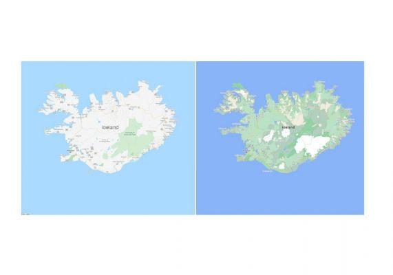
This update especially brings more credibility to large natural expanses. On the comparative pictures published by Google, we see that the latest version of Maps more accurately represents the area of forests, deserts or water points.
 After the update, Iceland has little to do with its original representation. © Google
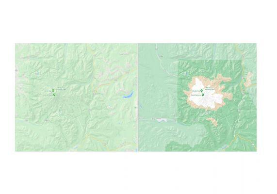
Google's new color-mapping algorithm allows it to graphically represent the density of vegetation in different regions of the globe. The topography of the peaks is also more accurately represented. It is now easier to identify the different levels of a pass or a mountain.
 The relief and topography gain in precision. © Google
“With this update, Google Maps has one of the most understandable views of the natural features [of the planet] than any other major application,” says Google on its blog.
Read also:
Google Maps: geolocation sharing is improving
Upcoming improvements in town
"Google Maps has at its disposal a satellite imagery in high definition for more than 98% of the world population", takes again the firm in its ticket. An asset that it will soon mobilize to improve the precision of urban mapping. At least in some big cities.
Ultimately, users in London, New York or San Francisco will be able to identify precisely where sidewalks, passageways and pedestrian islands are located in order to obtain ever more precise navigation. Google also believes that these additions will make Google Maps much safer for people with disabilities to use.
Limited to these enormous agglomerations at first, the firm indicates that other cities will gradually benefit from these additions.
 City navigation will soon be much more precise. © Google
Source : Google


